Offshore wind farms are playing a vital role in the energy transition, with at least 30 gigawatts’ (GW) worth of offshore wind energy set to be installed in German waters by 2030. Transporting the electricity generated by offshore wind farms from the North Sea and Baltic Sea to the land requires undersea cables that establish a connection to the onshore grid. Numerous countries including Germany have strict requirements for installing undersea cables, and operators have to factor these in during the planning stage. As an example, a post-burial survey (PBS) must be conducted to provide evidence that the actual position of a cable once it has been laid matches up with what had been planned. The aims of this kind of action include protecting existing infrastructures and preventing damage being caused by future construction activities. As offshore wind farms and other offshore infrastructure projects become more widespread, it is not unusual for cables to cross over one another — and this is only set to become more common in the future. Additionally, bottom currents and the resulting movements in sediment can lead to the positions of cables installed a few meters under the seabed changing over time. For this reason, cables need to be mapped before new infrastructures can be installed or repair work can be carried out. Acoustic or magnetic methods have been the tools of choice in this until now, but they are costly and demonstrate reliability issues.
This means that existing systems cannot have their cables surveyed over extensive areas or need the electricity to be switched off while cables are being surveyed. In the joint SASACD project, abbreviated for Seismo-Acoustic Synthetic Aperture Cable Detection, Fraunhofer IWES is working with the University of Bremen and TenneT Offshore GmbH to develop a novel, reliable, extensive, and cost-effective measuring system. The seismo-acoustic imaging method locates offshore cables with precision in the top layers of seabed sediment, allowing maintenance work to be planned more effectively and making offshore wind farms more reliable and economical to run. Fraunhofer IWES in Bremen is coordinating the project and is funded by the German Federal Ministry for Economic Affairs and Climate Action (BMWK).
Monitoring system with state-of-the-art positioning ensures localization with decimeter accuracy
What makes this new cable surveying method special is that it can identify cables whith a diameter of 25 centimeters or more with an accuracy of just a few decimeters. This is useful not only when laying new undersea cables — which cannot be installed directly next to existing ones due to the heat that is generated — but also when it comes to protecting old cables and repairing faulty connections.
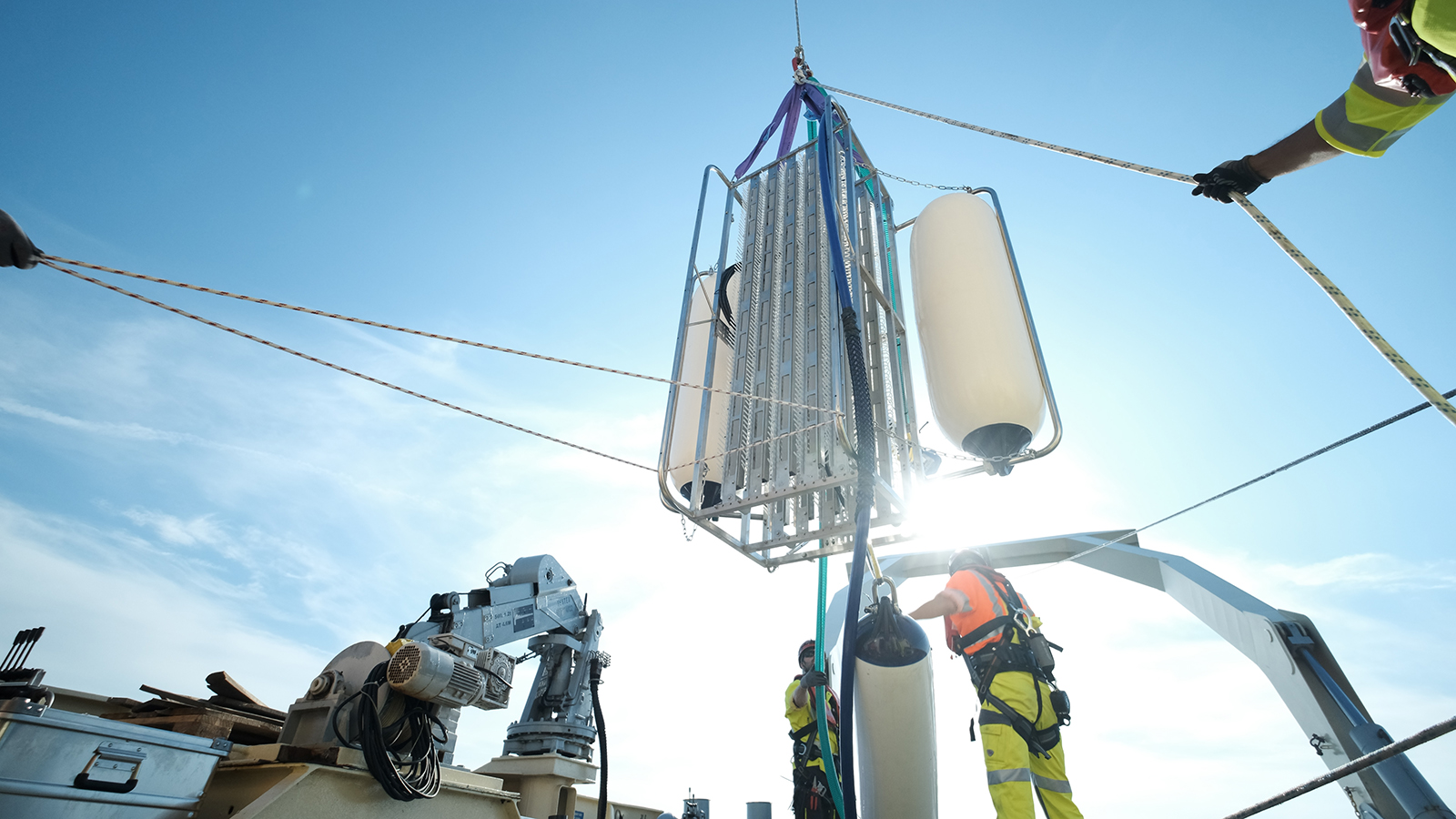
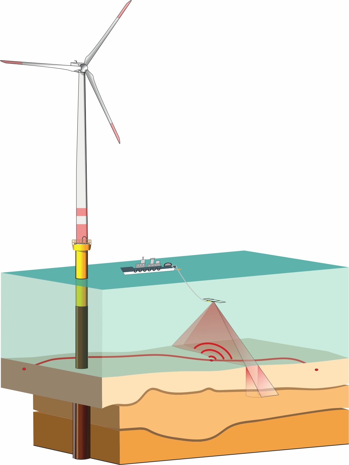
“Searching for cables underwater is extremely difficult. Without the right tools, you may as well be looking for a needle in a haystack,” says Dr. Jude Castelino, a geophysicist who is a researcher and project manager at Fraunhofer IWES. “This is where our seismo-acoustic measuring system comes in, as it allows us to home in on the approximate point in the subsurface where we believe the cable to be.” The measuring platform is able to investigate and scan large areas of the seabed and makes it possible to penetrate the sediment to a sufficient depth. To achieve this, the researchers are using tools including innovative methods of diffraction imaging and synthetic aperture, which have already proven themselves at Fraunhofer IWES in detecting boulders in marine sediments and are now being expanded as part of the SASACD project. The measuring system includes a towed system — complete with an ROTV (remotely operated towed vehicle) — that is equipped with special seismic sensors (hydrophones) and positioning systems. The equipment is towed by a surface vessel and can be located around ten meters or less above the seabed. During data acquisition, the hydrophones capture sound waves that are emitted by a signal source on the sea surface and reflected or scattered by the subsoil. This makes it possible to not only map out sediment layers but also locate cables, which may be installed at a depth of up to ten meters in the sediment. With this unique method of diffraction imaging, the acoustic energy scattered by the cables can be traced back to its point of origin. The data evaluation that then takes place is performed using specially developed software that displays high-resolution images of the cable positions in real time.
“There’s no need to switch off the cable being surveyed during the process. Keeping electricity transmission uninterrupted during the survey reduces the cost of running wind farms. Until now, cables had to be switched off for periods extending up to several days, depending on the project,” says Dr. Castelino. The method also allows the electricity that is generated to carry on being fed into the wider grid, in turn making it easier to plan the feed-in process. The next stage will involve test runs with a prototype, which can be used from even relatively small survey vessels.

